Geography Teaching Resources for 3rd Grade
- Plus Plan
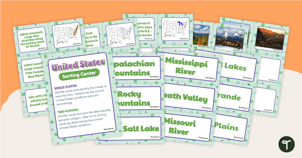
U.S. Land Features Sorting Center
Apply knowledge of the rivers, mountains, and physical features in the United States with a sorting activity.
- Plus Plan
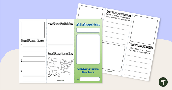
U.S. Landforms Brochure
Research and present knowledge of famous landforms in the United States with a brochure project.
- Free Plan
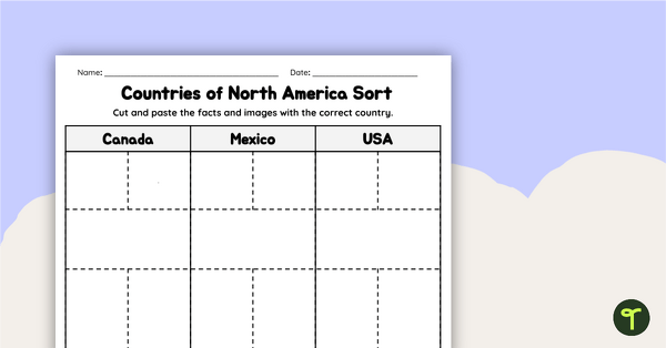
Countries of North America Sort
Practice identifying North American countries' locations, flags, and symbols with a quick and easy sorting worksheet.
- Plus Plan
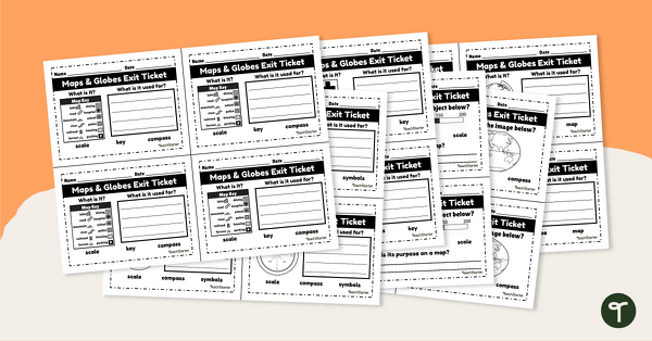
Maps and Globes-Exit Tickets
Assess student map and globe skills with twenty exit ticket worksheets.
- Plus Plan
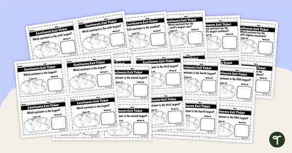
World Continents and Oceans Exit Tickets
Determine your students' mastery of Geography concepts with a set of twenty continents and oceans exit tickets.
- Plus Plan
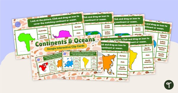
Continents and Oceans Interactive Clip Card Center
Turn geography into a digital learning experience with a Google Slides Interactive Continents and Oceans activity!
- Plus Plan
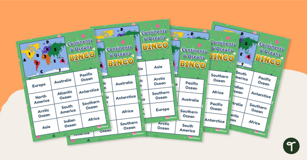
Continents and Oceans Bingo - Geography Game
Turn geography into a fun and educational learning experience by using our Continents and Oceans Bingo Game!
- Plus Plan
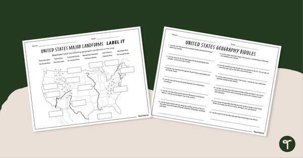
Major U.S. Land Features Worksheets
Discover and identify the major rivers, mountains, and landforms in the United States with an easy-to-use set of worksheets.
- Plus Plan
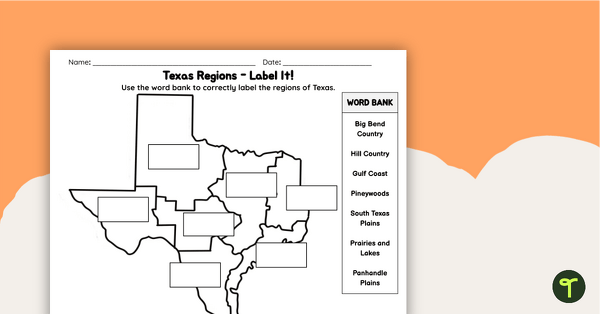
Labeling Texas Regions Worksheet
Supplement your Texas Social Studies curriculum with a region of Texas map labeling worksheet.
- Plus Plan
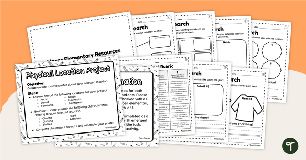
Differentiated Geographic Location Project-Primary and Upper Elementary
Uncover how geographic location affects the culture, customs, clothing, food, and overall lifestyle of humans with a differentiated research project.
- Plus Plan
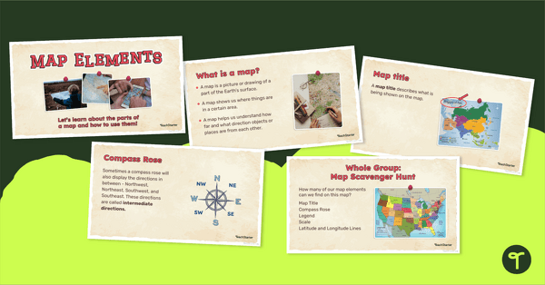
Me on the Map - Map Elements Presentation
Teach the components of a map with a map elements teaching presentation.
- Plus Plan
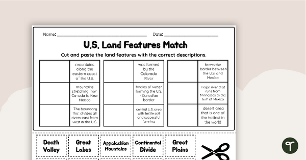
U.S. Land Features Matching Worksheet
Apply knowledge of the major U.S. rivers, mountains, and land features with a matching worksheet.
- Plus Plan
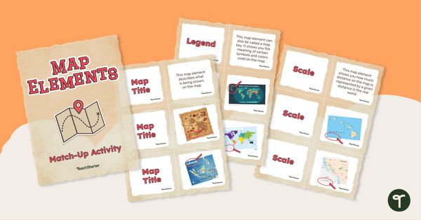
Elements of a Map Match-up Activity
Answer the question "What are the key elements of a map?" with a map element matching activity.
- Plus Plan
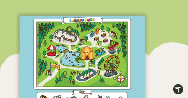
Leisure Land - Map Skills Worksheet
Practice using cardinal directions with this carnival map and worksheet.
- Plus Plan
Latitude and Longitude Banners
Latitude and longitude banners to display in the classroom when studying geography.
- Plus Plan
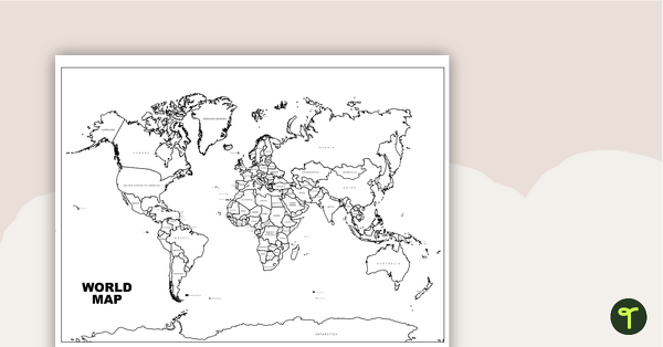
World Map with Countries Labeled
Print a labeled world map for the classroom with the various countries of the world.
- Plus Plan

Map of Washington With Counties and Capital
Download the best printable map of Washington state, including capital city and county lines, for your geography lessons.
- Plus Plan
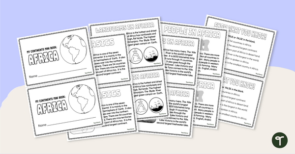
The Continent of Africa - Mini-Book
Explore the wonders and delights of the continent of Africa with this informative printable mini-book.
- Plus Plan
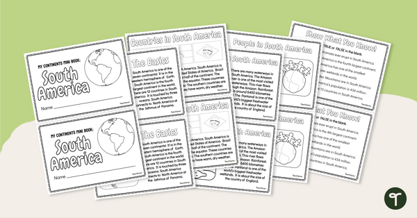
The Continent of South America - Mini-Book
Explore the wonders and delights of the continent of South America with this informative printable mini-book.
- Plus Plan
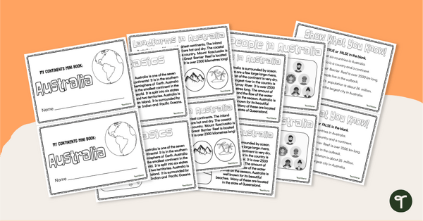
The Continent of Australia - Mini-Book
Explore the wonders and delights of the continent of Australia with this informative printable mini-book.
- Plus Plan
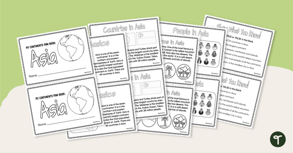
The Continent of Asia - Mini-Book
Explore the wonders and delights of the continent of Asia with this informative printable mini-book.
- Plus Plan
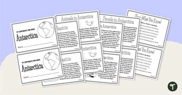
The Continent of Antarctica - Mini-Book
Explore the wonders and delights of the continent of Antarctica with this informative printable mini-book.
- Plus Plan
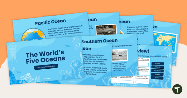
The World's Five Oceans - Instructional Slide Deck
Explore the world’s five oceans with this comprehensive slide deck.
- Plus Plan

Blank Map of Antarctica
Record and represent data about the location of significant places with this printable blank map of the continent of Antarctica.
- Plus Plan

Blank Map of Europe Template (Printable & Digital)
Get a printable & digital blank map of Europe for your continent and oceans lessons!
- Plus Plan
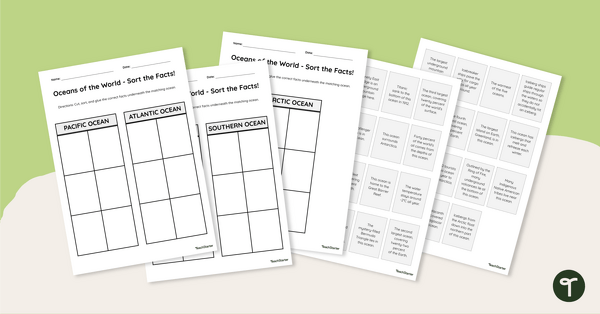
Oceans of the World - Cut and Paste Worksheet
Explore some key facts about the world’s five oceans with this cut-and-paste worksheet.
- Plus Plan
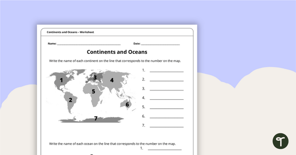
Continents and Oceans Worksheet
A worksheet to practice identifying the 7 continents and 5 oceans.
- Plus Plan

World Biomes Map
Locate and explore the different biomes of the world with this engaging classroom poster.
- Plus Plan
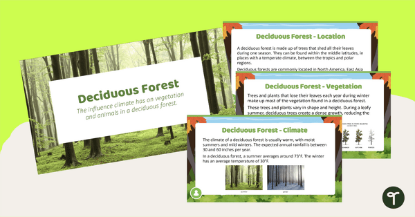
Deciduous Forest Biome Slide Deck
An 11-slide editable PowerPoint to use in the classroom when learning about deciduous forests.
- Plus Plan
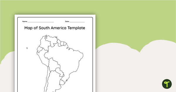
Blank Map of South America
This blank map of South America is perfect for elementary and middle school classes with editable Google Slides and printable PDF versions.
- Plus Plan
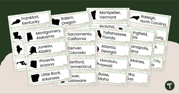
50 States and Capitals Word Wall Cards
Display the 50 states and capitals with 50 states map and word wall display.
- Plus Plan

Printable Map of Native American Tribes of North America
Print and use a detailed map showing the regions of native American tribes.